
It’s National Volunteer Week – the time of year when we all put extra effort into recognizing the generous people who make the world a better place. This is the week to high-five that front desk volunteer at the blood donation center; fist bump a crossing guard; and flash those pearly whites at families working the soup kitchen.
There’s another group of volunteers who are not quite as easy to thank via high-fives and such: digital mappers. They’re not easily identifiable around town and aren’t typically donning Red Cross hats, but the work they perform is essential to Red Cross relief operations during international disasters.
Digital mappers update the maps of disaster-affected areas in the wake of international emergencies. These humanitarians use OpenStreetMap—crowd-sourced mapping technology—to create detailed and entirely open maps of the areas affected by disasters. Using their own computers, the volunteers trace roads, buildings and bodies of water. The Red Cross then uses these crowd-sourced maps to measure damage and deliver aid to people in need.
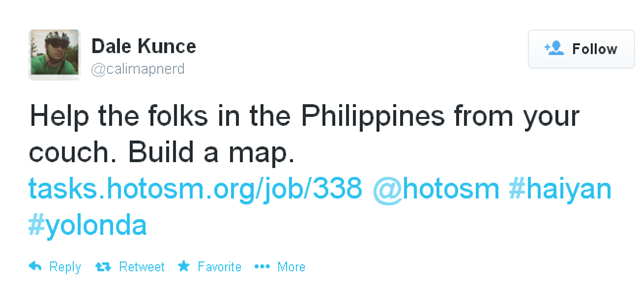
Volunteer mappers don’t need to be experts (or even close!) to update OpenStreetMap. In fact, Red Cross map guru, Dale Kunce (okay, he’s an expert) put a call out on his Twitter account the day after Typhoon Haiyan made landfall in November – hoping that anyone with a few extra minutes would pitch in:
Volunteers from across the country and around the world answered his call. About 1,700 remote mappers traced the affected area through the Humanitarian OpenStreetMap Team (HOT). Together, they made 4.8 million edits to the Philippines base map that was loaded onto Red Cross relief workers’ GPS devices and utilized on the ground. When I talked to Robert Banick, a Red Cross mapper who deployed to the Philippines in the wake of the typhoon, he told me, “The maps saved [disaster specialists] from getting lost or wasting time when they had to reroute off damaged roads. They were able to give directions to Filipino drivers. It all leads to more efficient delivery of supplies to people affected by Typhoon Haiyan.”
The Red Cross and HOT are now organizing digital mapping volunteers to map cities and towns affected by Ebola – a deadly virus spreading in West Africa. These humanitarians made more than 1.5 million edits to OpenStreetMap last weekend, which is roughly equivalent to a year’s worth of work by an advanced, paid mapper. This Ebola map adds focus and efficiency to the global Red Cross network’s assistance in these affected communities.
We can’t physically fist bump our digital mapping volunteers and I don’t think sending an emoji would express how impactful and important their work is to Red Cross international relief work. I guess a huge “THANK YOU” from the proverbial rooftops will need to do for now. THANK YOU, mappers!! Happy National Volunteer Week.
Want to be a digital mapping volunteer? Learning the ropes literally takes 10 minutes. Visit to OpenStreetMap to get started and let us know when you’ve begun.