 When news of a major fire in Valparaíso, Chile made headlines on Monday, some people sent donations. Some people took to social media. And some people mapped.
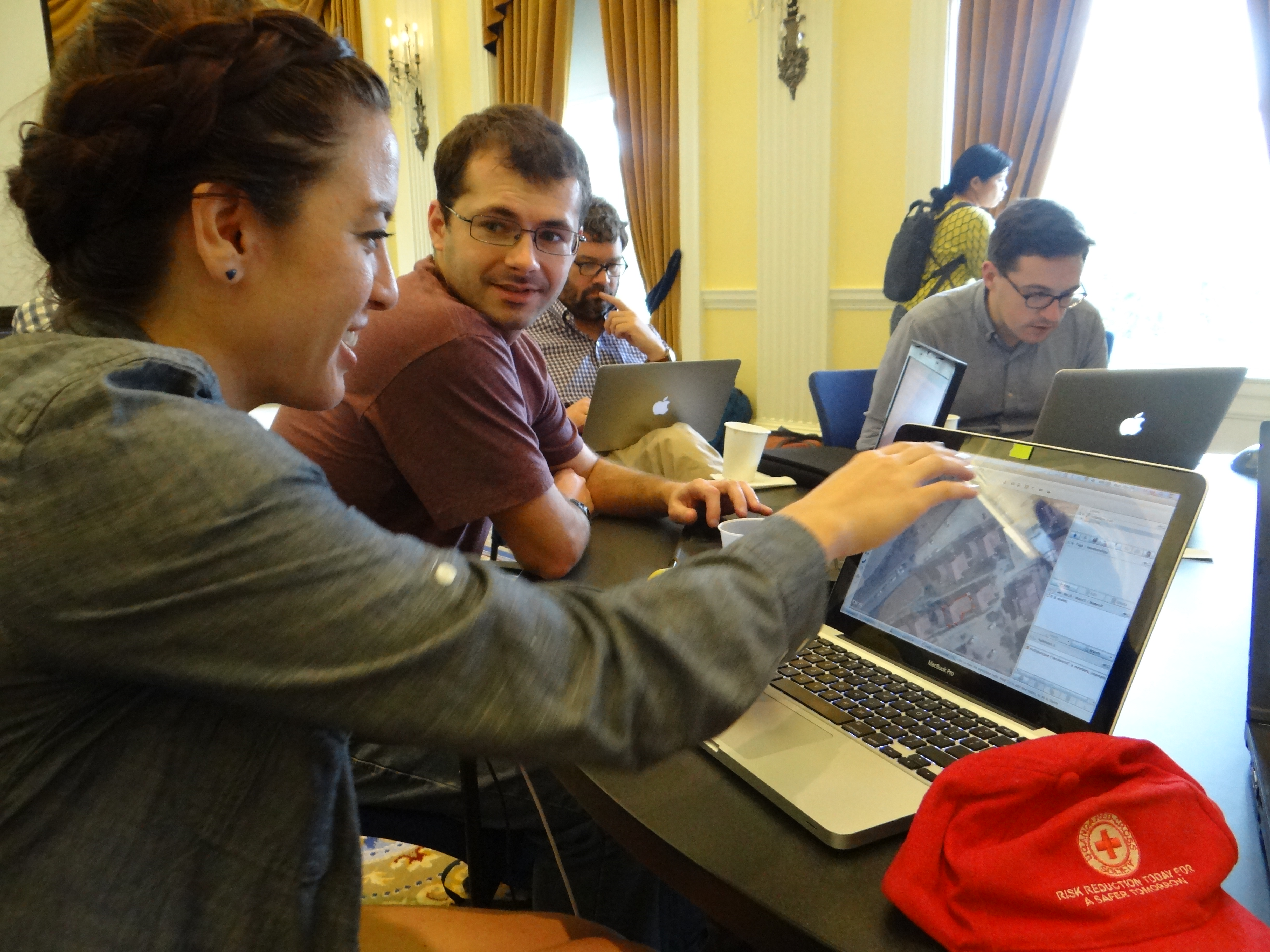
Not wasting any time, digital volunteers gathered at the American Red Cross headquarters Monday morning, grabbed some caffeine and began to make a detailed map of neighborhoods affected by the fire.
The volunteers were in town attending a conference about OpenStreetMap—crowd-sourced mapping technology that’s been called the “Wikipedia of maps.” They congregated at the Red Cross building to work on individual projects, but when they heard that local Chilean mappers, Red Cross disaster specialists, and the Humanitarian OpenStreetMap Team (HOT) were calling for help in Valparaíso, 16 digital mappers volunteered to pitch in.
In the span of a few hours, they were able to build a map of Chilean neighborhoods that had not previously existed. Using satellite imagery, they traced the outline of buildings that stood before the fire. Responders can compare this “before” map with the post-fire landscape to understand the amount of damage done by the disaster. Stephen Smith of Burlington, Vermont explained it to me like this, “With a big fire, it’s difficult to know what was destroyed. If you can see where buildings used to stand, responders might know where to look for survivors.” Stephen learned how to use the OpenStreetMap technology in less than 10 minutes and was able to trace about 100 buildings in just an hour.
The Red Cross finds digital maps increasingly useful during international disasters. When Typhoon Haiyan made landfall in the Philippines last November, the Red Cross and HOT asked volunteers to build a map of storm-affected towns and 1,700 people answered the call. The Red Cross loaded the updated maps onto relief workers’ GPS devices—it not only saved them time navigating to villages while delivering relief supplies, but also helped teams to assess damages.
While Monday’s volunteers had a special interest in mapping from the get-go, one beautiful thing about this type of crowd-sourced mapping is that people don’t need specialized skills to contribute. Anyone can learn how to map at OpenStreetMap and can find humanitarian mapping “tasks” at HOT’s website, where the Red Cross has also asked help mapping areas in Guinea and Mauritania.