Remember when you were a little kid and one of the first things you learned were shapes –squares, triangles, lines and circles. Those shapes that form when you are three seem so innocent and simple, but they are vital in the fight against the Ebola virus.
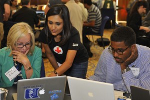
On Friday, volunteers gathered at American Red Cross for an open source crowd mapping event with MapGive and Humanitarian OpenStreetMap Team. Square by square and line by line, volunteer mappers came together to trace neighbor’s homes, access roads and warehouses in parts of Sierra Lione and Liberia by using satellite imagery. These efforts support the global response to combat the Ebola outbreak, a deadly virus that’s quickly spreading across West Africa.
Tracing shapes may seem mundane and tedious to some, but try telling that to the mappers themselves. Like any volunteer activity, there’s a reason behind what we all do. Maybe you have a passion for technology and this groundbreaking open source mapping is exciting and thrilling; maybe you’re in college and looking for something to do with your spare time without having to leave the comfort of your very own dorm; or maybe there’s family, friends and a personal connection that draw you to the cause. Whatever it may be, each volunteer mapper is providing invaluable information to organizations such as the global Red Cross network and Doctors Without Border that are trying to prevent the spread of Ebola.
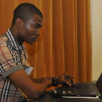
 For Benjamin Freeman Jr., his connection to virtual mapping was personal. Benjamin is visiting the United States from Liberia after being accepted to be a part of the Mandela Washington Fellowship, a flagship program started by President Obama. He heard about open crowd mapping and was immediately intrigued and eager to get started. For him, this was a small way he could make an impact in his country.
“Mapping is the best way I can work with others to make a difference,” Benjamin said. “I miss my family in Liberia, but I see the visual impact I’m making and feel a little better knowing I’m helping them.”
The next table over, Ranjani Sridharan, from Kenya, was inspired to start mapping after hearing Benjamin Freeman Jr., speak at a seminar encouraging people to map. Her husband, Aswin Subanthore, from India, already has a passion for mapping being a geography professor at University of the District of Columbia. However, it wasn’t until 2005 that his mapping experience really began when he visited India, his home country, after a massive earthquake in Indonesia in December 2004 caused a tsunami affecting nearby countries, including India. Ranjani and Aswin both map together feel this gives them a purpose.
Each trace of a lined road leads to clear transportation routes, each trace of a square house leads to in-person Ebola awareness and education; each trace on a map leads to humanitarian aid that will fight against the Ebola virus. Red Cross has 1,500 volunteers working in the affected areas, but volunteering has also spread its wings to the comfort of your own home. You can help too. Visit MapGive to get involved or learn more about Red Cross international efforts by visiting redcross.org.

