American Red Cross disaster relief has taken on many forms since our inception in 1881, when Clara Barton dispatched two men to help distribute relief goods and cash for victims of a Michigan …

American Red Cross disaster relief has taken on many forms since our inception in 1881, when Clara Barton dispatched two men to help distribute relief goods and cash for victims of a Michigan …
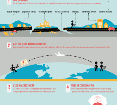
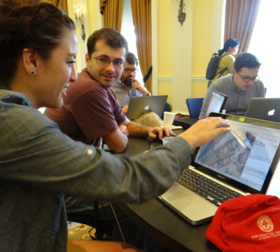
After disasters strike, updated maps are extremely important to emergency responders. These maps help us measure the damage, identify priority areas, navigate our way around damaged roadways, and more efficiently …
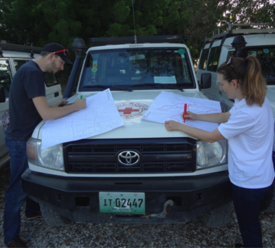
This post was written by Emily Eros, a member of the American Red Cross mapping team, who recently traveled to Canaan, Haiti. You can see more about the Red Cross’ …
This post was written by Samuel Estabrook, as part of the Words Against Ebola campaign – a Red Cross initiative to promote knowledge, fight stigma, alleviate fear and overcome complacency …
This post was written by Dale Kunce, Senior Geospatial Engineer and GIS Team Lead at the American Red Cross. Dale is spearheading the American Red Cross’s involvement in the Missing …
When news of a major fire in Valparaíso, Chile made headlines on Monday, some people sent donations. Some people took to social media. And some people mapped. Not wasting any …

Today is Blog Action Day. This year’s theme is the Power of We. The Power of We is a celebration of people working together to make a positive difference in the world, …
With the hard work of our GIS mapping teams, local volunteers and you we will help the communities of Gulu and Lira develop maps.
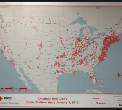
Map of every shelter we’ve opened since January 1, 2011:
Now, we’d like to present the framework for a path forward. After reviewing the notes, speeches, and wiki feedback from the summit, we’ve outlined 5 areas where we can make headway over the next few months.